Toggle light / dark theme

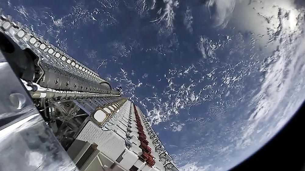
Rice University students are developing a research satellite to help alleviate the space junk orbiting our planet.

The OwlSat CubeSat will collect data over the course of one year to see how extreme ultraviolet radiation, which is always emitted from the sun but becomes more intense during events such as solar flares, can alter a satellite’s path in low-Earth orbit, the area where the International Space Station resides. Better understanding a satellite’s orbit can help prevent collisions that can create space junk, said Ryan Udell, president of Rice University’s chapter of Students for the Exploration and Development of Space.

“We don’t have a fool-proof way of mapping orbits,” Udell said. “There are very good predictors out there, but we can’t fully predict it.”
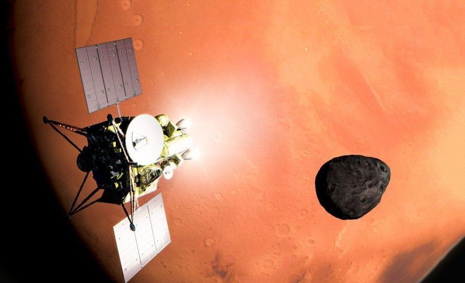
JAXA, Japan’s national space agency, has just approved a robotic mission to visit the Martian moons Phobos and Deimos and retrieve a small sample from the former to bring back to Earth.

The mission plan: It’s called Martian Moon eXploration, or MMX. JAXA currently plans to launch MMX in 2024 and make it to the Martian system the following year. MMX will spend three years in the system studying and mapping the moons. The mission will make use of 11 different instruments, including a NASA-funded instrument called MEGAE that will measure the elemental composition of both bodies (perhaps revealing signs of ancient water).

The mission will also deploy a small rover to zip around the surface of Phobos, not unlike what JAXA’s Hayabusa2 mission deployed on the surface of the asteroid Ryugu.

A region beneath the rough waters of the North Sea, known as Doggerland, holds archaeological clues to the past. Watch how researchers are using advances in mapping and leads from dredging sites to piece together the history of this vanished landscape.

Read the story: https://www.sciencemag.org/news/2020/01/relics-washed-beaches-reveal-lost-world-beneath-north-sea

Europe’s Lost Frontiers Research:
The study was supported by European Research Council funding through the European Union’s Horizon 2020 re-search and innovation programme (project no. 670518 LOST FRONTIERS, https://erc.europa.eu/ https://lostfrontiers.teamapp.com/) and the Estonian Research Council grant (https://www.etag.ee/, project no. PUTJD829). We acknowledge PGS (https://www.pgs.com/) through provision of data under license CA-BRAD-001-2017. The Brown Bank expeditions were supported through the Flanders Marine institute (VLIZ, http://www.vliz.be/en) and the Royal Belgian Institute of Natural Sciences (https://odnature.naturalsciences.be/belgica/en/)

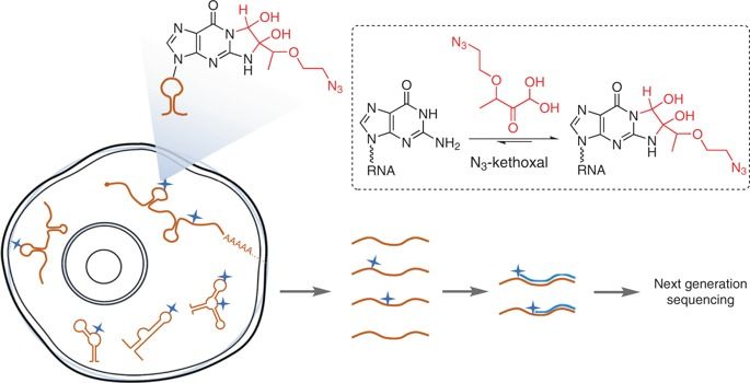
RNA secondary structure is critical to RNA regulation and function. We report a new N3-kethoxal reagent that allows fast and reversible labeling of single-stranded guanine bases in live cells. This N3-kethoxal-based chemistry allows efficient RNA labeling under mild conditions and transcriptome-wide RNA secondary structure mapping. The authors designed a chemical probe, azido-kethoxal, to specifically label guanosine in single-strand RNAs in live cells that could be used to determine transcriptome-wide RNA secondary structures.

Essentially the higgs mode is like a developer mode for materials and even physics by itself. It could make metals that are as light as a feather but essentially as strong as a universe. It could make essentially near infinitely strong metals that could be put on spaceships to handle all manners of energy blasts. Even weird things could happen where like even changing dimension al physics of areas. Essentially a near cartoon like physics or even prove the existence of the stranger things dimension really happened. Even keep out other dimensions from entering our universe. Even controlling the universe itself by healing it. Essentially like it could allow the monitor from halo kinda developer mode to modify gravity or all variables or even bring new variables into the dimension.


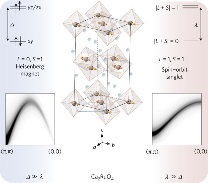
Condensed-matter analogues of the Higgs boson in particle physics allow insights into its behaviour in different symmetries and dimensionalities1. Evidence for the Higgs mode has been reported in a number of different settings, including ultracold atomic gases2, disordered superconductors3, and dimerized quantum magnets4. However, decay processes of the Higgs mode (which are eminently important in particle physics) have not yet been studied in condensed matter due to the lack of a suitable material system coupled to a direct experimental probe. A quantitative understanding of these processes is particularly important for low-dimensional systems, where the Higgs mode decays rapidly and has remained elusive to most experimental probes. Here, we discover and study the Higgs mode in a two-dimensional antiferromagnet using spin-polarized inelastic neutron scattering. Our spin-wave spectra of Ca2RuO4 directly reveal a well-defined, dispersive Higgs mode, which quickly decays into transverse Goldstone modes at the antiferromagnetic ordering wavevector. Through a complete mapping of the transverse modes in the reciprocal space, we uniquely specify the minimal model Hamiltonian and describe the decay process. We thus establish a novel condensed-matter platform for research on the dynamics of the Higgs mode.

In-car satnav systems and mobile mapping apps have made it much easier to travel from one place to another without getting lost, but a new innovation promises to help fix a remaining pain point – getting in the right lane at intersections.

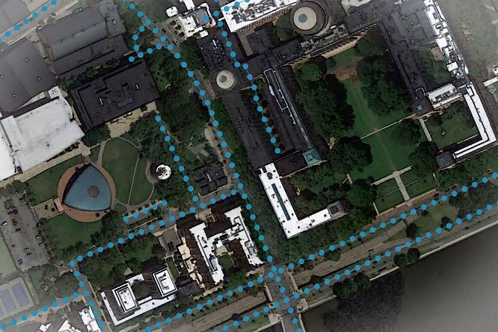
Today’s mapping apps aren’t always much help if you’re at an unfamiliar intersection and aren’t sure exactly where on the road your car is supposed to be: the apps often don’t have the detail or the knowledge to warn you in good time about changing lanes.

The system developed by researchers at MIT and the Qatar Computing Research Institute uses satellite imagery to augment existing mapping data, but the smart part is applying artificial intelligence to work out the layout of roads hidden by trees and buildings.

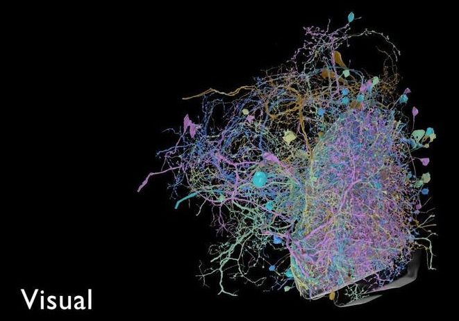
Scientists from Google and the Janelia Research Campus in Virginia have published the largest high-resolution map of brain connectivity in any animal, sharing a 3D model that traces 20 million synapses connecting some 25,000 neurons in the brain of a fruit fly.

The model is a milestone in the field of connectomics, which uses detailed imaging techniques to map the physical pathways of the brain. This map, known as a “connectome,” covers roughly one-third of the fruit fly’s brain. To date, only a single organism, the roundworm C. elegans, has had its brain completely mapped in this way.

Connectomics has a mixed reputation in the science world. Advocates argue that it helps link physical parts of the brain to specific behaviors, which is a key goal in neuroscience. But critics note it has yet to produce any major breakthroughs, and they say that the painstaking work of mapping neurons is a drain on resources that might be better put to use elsewhere.

A new ‘Data in Action’ ArcGIS Story Map at NASA’s Land Processes Distributed Active Archive Center (LP DAAC) maps deforestation in Cambodia using NASA Moderate Resolution Imaging Spectroradiometer (MODIS) Land Cover and Vegetation Continuous Fields datasets to highlight land cover changes.

The southeastern Asian country of Cambodia continues to struggle with extensive loss of its forests. In 2013, Dr. Matthew Hansen and colleagues found that Cambodia lost nearly 12,600 square kilometers of forest from 2000 to 2012. This ranked fifth worldwide for the time period (Hansen et al. 2013). Since 2012, Cambodia has continued to experience forest loss at alarming rates, loss that has extended even into the country’s national parks and protected areas. Large scale vegetation loss, or gains, can be monitored using Earth observation land data products derived from the Moderate Resolution Imaging Spectroradiometer (MODIS) instrument on-board the Terra satellite. Data products like these are archived and distributed free of charge by NASA’s LP DAAC.