Toggle light / dark theme

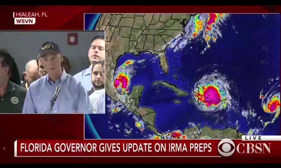
You know those jokes about how people first go online and on social media in times of emergencies before they actually do something about said emergency? Well it’s time to turn that new habit on its head and actually make it useful. Florida governor Rick Scott urged residents to take advantage of apps like Gas Buddy, Google Maps, and Expedia to get the latest information on gas availability and road closures in preparing for hurricane Irma’s landfall. Of course, only before and after the storm, not during and especially not inside it.”

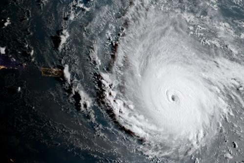
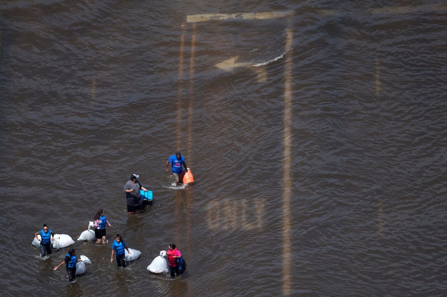
“The devastation in Houston left in Harvey’s wake has sent Florida scrambling to prepare for an even more frightening Irma. This has caused no small amount of panic buying of supplies and gas. The latter has been especially problematic and one that cannot be easily solved. The only temporary answer is to make sure you can actually find an open gas station before you actually get there.”

“Gas Buddy is stepping up to task to go beyond the app’s original purpose. Times like these, people are less concerned about finding the cheapest prices than they are finding gas in the first place. Like in Harvey’s case, Gas Buddy has activated its Fuel Tracker to show stations that have no power, no gas, or both. This information is sourced from users who already had the misfortune of finding that out the hard way.”

Read more

Climate change, they didn’t listen then, perhaps they’ll listen now.

Crippled water system, chemical plant blaze, vivid examples of Harvey’s cascading effects.


Authorities said at least 45 people were killed due to the storm, a number expected to increase.

Read more

Click on photo to start video.

http://reut.rs/2va7JDI via @ReutersTV

Read more

The report found that more than half of global industrial emissions since 1988 – the year the Intergovernmental Panel on Climate Change was established – can be traced to just 25 corporate and state-owned entities. The scale of historical emissions associated with these fossil fuel producers is large enough to have contributed significantly to climate change, according to the report.


A relatively small number of fossil fuel producers and their investors could hold the key to tackling climate change.

Read more

Global food production is one of the key societal challenges of the 21st century. A growing world population with the simultaneous upheaval caused by climate change demand new methods of cultivating crops in regions with unfavourable climates. A closed greenhouse is a good way of growing food in deserts and low-temperature regions – as would be the case on missions to the Moon and Mars – as it permits harvesting regardless of the weather, the Sun and specific seasons. In a closed greenhouse, water consumption is immensely reduced and there is no need for pesticides and insecticides. This kind of model greenhouse will set off for the Antarctic at the end of 2017 for a year of long-term testing under extreme conditions as part of the EDEN-ISS project. Unparalleled elsewhere in the world, this Antarctic greenhouse was presented to the public for the first time at the Bremen site of the German Aerospace Center (Deutsches Zentrum für Luft- und Raumfahrt; DLR) on 7 July 2017.

“DLR is pursuing application-oriented research within the EDEN-ISS project. Its purpose is to bring fresh impetus to food production on Earth and for human space flight,” says Hansjörg Dittus, DLR Executive Board Member for Space Research and Technology. “In doing so, we are advancing the cause of a key technology that will provide a fresh diet to inhabitants of climatically harsh regions – in our case the Antarctic – as well as to astronauts on future long-term missions.”

A year on the eternal ice.

Read more

The researchers think this unseasonably warm air was due primarily to the powerful 2015–2016 El Niño. As they write in their paper, the El Niño climate pattern, which starts with high sea surface temperatures in the equatorial Pacific, tends to promote the advection of high pressure air masses over this part of Antarctica. But they’re not sure—after all, the comparably-strong 1997–98 El Niño event didn’t cause widespread melting in West Antarctica. And although the data points to a correlation between El Niño and melty ice in West Antarctica, that doesn’t necessarily imply causation.


300,000 square miles is nearly twice the area of California. It’s difficult to visualize a space that vast, but go ahead and give it a try. Now, imagine this California plus-sized chunk of land is covered in thousands of feet of ice. Then, all of a sudden, that frozen fortress becomes a wading pool.

In January 2016, over the course of just a few weeks, a 300,000 square mile chunk of the West Antarctic ice sheet started turning to slush, in one of the largest melt-outs ever recorded. Scientists with the ARM West Antarctic Radiation Experiment (AWARE), who reported the epic defrost in Nature Communications last week, believe it was related to the 2015–2016 El Niño. Troublingly, they think massive melts like this could be a harbinger of the future—but more research is needed before we can be sure.

The West Antarctic ice sheet has been called the “weak underbelly” of the Antarctic continent, and for good reason: Its glaciers, which contain enough frozen water to raise global sea levels by at least 10 feet, are shedding mass rapidly as the planet heats up. The prevailing wisdom is that warm ocean waters are weakening West Antarctica’s floating ice shelves from below, and causing inland ice sheets to detach from the underlying land surface at their so-called “grounding line.” But a recent survey found evidence for ephemeral lakes and river networks across Antarctica, raising concerns that surface melting could also play a significant role in ice sheet disintegration.

Read more

A new study led by Northern Illinois University geography professor Wei Luo calculates the amount of water needed to carve the ancient network of valleys on Mars and concludes the Red Planet’s surface was once much more watery than previously thought.

The study bolsters the idea that Mars once had a warmer climate and active hydrologic cycle, with water evaporating from an ancient ocean, returning to the surface as rainfall and eroding the planet’s extensive network of valleys.

Satellites orbiting Mars and rovers on its surface have provided scientists with convincing evidence that water helped shape the planet’s landscape billions of years ago. But questions have lingered over how much water actually flowed on the planet, and the ocean hypothesis has been hotly debated.

Read more