https://www.youtube.com/user/WWFClimate/featured.
*To date, most studies have focused on understanding how much carbon is stored above ground (in trees and other plants, for example). This research, however, revealed that when you look below ground and get into deeper levels of soil, there are massive deposits of carbon.*
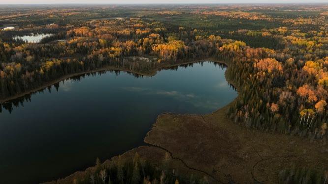
Canada’s first-ever national carbon map reveals the location of billions — yes, billions — of tonnes of carbon stored in ecosystems across the country. This data, and how we use it, could alter the pace of climate change.
Over the span of two years, researchers fed data from existing soil samples collected from across the country, as well as long-term satellite data and topographic and climate variables, into a machine-learning algorithm. Researchers were able to estimate carbon at a 250-metre spatial resolution in different carbon pools (soils and plant biomass), as well as at multiple depths (1−2 metres).
Tens of thousands of field measurements were fed into a machine-learning algorithm to train satellite observations, including space-based laser scanning data, to estimate carbon stocks in plant biomass and soils across Canada. The resulting national carbon map will have a huge impact on the way conservation activities and policies are approached to prioritize nature-based climate solutions.
## ORIGINAL PAPER
Large soil carbon storage in terrestrial ecosystems of Canada
https://www.essoar.org/doi/10.1002/essoar.10507117.
Abstract
Terrestrial ecosystems of Canada store a large amount of organic carbon © in soils, peats and plant materials, yet little is known about the C stock size and distributions, both spatially and in various C pools. As temperature rises, C is becoming available for disturbance, decomposition and eventual release into the atmosphere, which makes the quantification of C stocks in terrestrial ecosystems of Canada of high interest for the assessment of climate change impacts and conservation efforts. We used a large number of field measurements, multi source satellite, climate and topographic data and a machine learning algorithm to produce the first wall-to-wall estimates of C stocks and uncertainties in plants and soils of Canada at 250 m spatial resolution. Our findings show that above and below ground live biomass and detritus store a total of 21.1 Pg C. Whereas the Canadian soils store 384 (& plus mn; 214 90% confidence interval) Pg organic C in the top 1 m, 92 Pg C of which are stored in peatlands, confirming that the soil organic C dominates terrestrial carbon stocks in Canada. We also find previously under-reported large soil organic C stocks in forested peatlands on the boreal shields of Canada. Given that Canada is warming twice the global average rate and Canadian soils store approximately 25% of world soil C stocks in top 1 m, initiatives to understand their vulnerabilities to climate change and disturbance are indispensable not only for Canada but also for the global C budget and cycle.
## SEE ALSO
WWF Live Streams COP26
The study will be presented at the WWF-International Pavilion at COP26 in Glasgow, Scotland, today, Nov. 10 at 11:00 AM Eastern Time.
Thanks to WWF
John Horgan Sonia Furstenau.
#COPS26 #CarbonStorage #ClimateChange #CDNPoli #BCPoli #Forestry #CBMCFS3 #GenericCarbonBudgetModel.
https://www.facebook.com/groups/1632045180447285/permalink/3044675709184218/
Canada’s first-ever national carbon map reveals the location of billions of tonnes of carbon stored in ecosystems across the country. This data, and how we use it, could alter the pace of climate change.