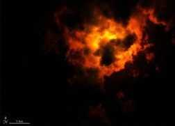
The eruption of Iceland’s Fagradalsfjall volcano is so vibrant it can be seen from space, and satellites orbiting hundreds of miles above the ground have captured images of the eruption from orbit.
Using data from the Operational Land Imager on NASA and the U.S. Geological Survey’s Landsat 8 satellite, NASA data visualizer Joshua Stevens pieced together a false-color image of the eruption. The image shows the eruption at 10:25 p.m. local time (2225 GMT) on March 22, three days after it started on March 19.
