
The asteroid is estimated to be 1,100 ft. in diameter, while the Empire State Building stands at approximately 1,400 ft. tall.
The asteroid is estimated to be 1,100 ft. in diameter, while the Empire State Building stands at approximately 1,400 ft. tall.

The reality of COVID19 raises a critical question in the mind of Adam Ethan Loeb a young Belgium boy regarding the extinction of the human person. This questions birthed “Adam’s Dream” which for him will help in “Saving Humanity From Extinction”, by “Availing a Multiplanetary Education for the present and Future Generations“
This 12year old boy highly influenced by Elon Musk and Peter H. Diamandis believes that a multiplanetary existence could have prevented the spread of coronavirus.
This young Space Enthusiast believes that since they are the future of tomorrow, well structure Young Space Education System should be availed because the Future is Faster than we think.
In explaining his vision Adam explained, “Adam’s Dream is my vision about the future with regard to preserving our kind and other living things. This idea struck my mind during this novel coronavirus outbreak. As the spread increases day in and day out, I was scared and asked my mum the question, “mum, do you know that living in space could have saved or preserved humanity better”? My reason is, if we become multiplanetary, it will solve the problem of overpopulation and make the human person more creative and resilient.
Thus, in this project, I will be preparing my generation and the ones to come to become multiplanetary Species. We have many Space Advocates; there is no proper attention giving to the younger generation. The future is obscure for my generation, and I want to lead them to light through the help of those who know better in compliance with “Adam’s Dream” rooted in Saving Humanity from Extinction by Availing a Multiplanetary Education for the present and Future Generations. In this, we can have a Sustainable “Kosmic” Environment for Prosperous Living.
Reading the works of Elon Musk gave me the conviction that as a Multiplanetary Activist, I can do this. Elon started thinking about Space at 14 years; I began at 10years. He is no doubt my number one role model followed by Peter H. Diamandis with my effort in understanding the teachings of Sara Seager – Planetary Scientist, K. Radhakrishnan, Carolyn Porco, Jill Tarter, Neil deGrasse Tyson, Liu Yang, Steve Squyres, Louis Allamandola, and David Spergel. I will have a better approach to harnessing the reality of Multiplanetary for my generation on those to come. The reality of Space is faster than you think.”
Posted in astronomy, computing, cosmology, engineering, events, hacking, health, information science, innovation, open source, satellites, science, software, space | Leave a Comment on NASA, partners launch virtual hackathon to develop COVID-19 solutions

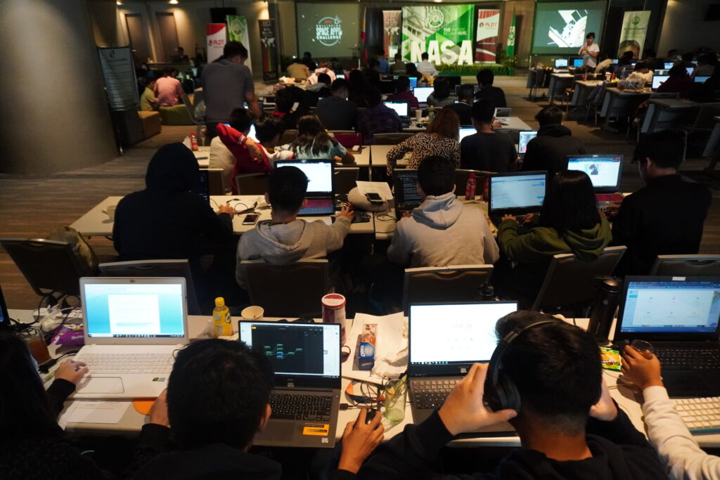
The U.S. space agency National Aeronautics Space Administration (NASA), European Space Agency (ESA), and Japan Aerospace Exploration Agency (JAXA) are inviting coders, entrepreneurs, scientists, designers, storytellers, makers, builders, artists, and technologists to participate in a virtual hackathon May 30–31 dedicated to putting open data to work in developing solutions to issues related to the COVID-19 pandemic.
During the global Space Apps COVID-19 Challenge, participants from around the world will create virtual teams that – during a 48-hour period – will use Earth observation data to propose solutions to COVID-19-related challenges ranging from studying the coronavirus that causes COVID-19 and its spread to the impact the disease is having on the Earth system. Registration for this challenge opens in mid-May.
“There’s a tremendous need for our collective ingenuity right now,” said Thomas Zurbuchen, associate administrator for NASA’s Science Mission Directorate. “I can’t imagine a more worthy focus than COVID-19 on which to direct the energy and enthusiasm from around the world with the Space Apps Challenge that always generates such amazing solutions.”
The unique capabilities of NASA and its partner space agencies in the areas of science and technology enable them to lend a hand during this global crisis. Since the start of the global outbreak, Earth science specialists from each agency have been exploring ways to use unique Earth observation data to aid understanding of the interplay of the Earth system – on global to local scales – with aspects of the COVID-19 outbreak, including, potentially, our ability to combat it. The hackathon will also examine the human and economic response to the virus.
https://www.youtube.com/watch?v=p_quOKBRJKs
ESA will contribute data from the Sentinel missions (Sentinel-1, Sentinel-2 and Sentinel-5P) in the context of the European Copernicus program, led by the European Commission, along with data from Third Party contributing Missions, with a focus on assessing the impact on climate change and greenhouse gases, as well as impacts on the economic sector. ESA also is contributing Earth observation experts for the selection of the competition winners and the artificial-intelligence-powered EuroDataCube.
“EuroDatacube will enable the best ideas to be scaled up to a global level,” said Josef Aschbacher, director of Earth Observation Programmes at ESA. “The pandemic crisis has a worldwide impact, therefore international cooperation and sharing of data and expertise with partners like NASA and JAXA seems the most suitable approach.”
JAXA is making Earth observing data available from its satellite missions, including ALOS-2, GOSAT, GOSAT-2, GCOM-C, GCOM-W, and GPM/DPR.
“JAXA welcomes the opportunity to be part of the hackathon,” said JAXA Vice President Terada Koji. “I believe the trilateral cooperation among ESA, NASA and JAXA is important to demonstrate how Earth observation can support global efforts in combating this unprecedented challenge.“
Space Apps is an international hackathon that takes place in cities around the world. Since 2012, teams have engaged with NASA’s free and open data to address real-world problems on Earth and in space. The COVID-19 Challenge will be the program’s first global virtual hackathon. Space Apps 2019 included more than 29,000 participants at 225 events in 71 countries, developing more than 2,000 hackathon solutions over the course of one weekend.
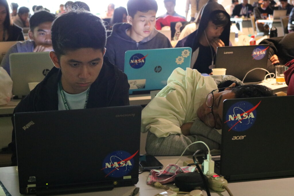
Many Filipinos participated in this annual hackathon since 2016. Recently, a dengue mapping forecasting system was developed by data scientists from CirroLytix using satellite and climate data with the goal of addressing the sustainable development goals of the United Nations. This web application, called Project AEDES won globally for the best use of data. “Earth observation data has the potential to be used in fighting epidemics and outbreaks threatening humanity nowadays, as well as to analyze its socio-economic impact,” according to software developer Michael Lance M. Domagas, who led the Philippine hackathon in collaboration with De La Salle University, PLDT, Department of Science and Technology, United Nations Development Programme, and the U.S. embassy. The very first Philippine winner used citizen science and environmental data to develop a smartphone application informing fishermen the right time to catch fish. ISDApp is currently being incubated at Animo Labs.
Space Apps is a NASA-led initiative organized globally in collaboration with Booz Allen Hamilton, Mindgrub and SecondMuse. The next annual Space Apps Challenge is scheduled for October 2–4.
Registration opens May 12. https://covid19.spaceappschallenge.org/
Love it or hate it, Starlink might be the biggest space undertaking ever once completed. The combined mass of the Starlink satellite constellation exceeds any prior space endeavor. The SpaceX network provides global satellite Internet access will weigh in more than any other prior space program. The constellation consisting of thousands of mass-produced small satellites in low Earth orbit adds up quickly. Each Falcon 9 launch gets packed full of sixty Starlink satellites. The satellites neatly fit in both size and mass limitations of the Falcon 9.

In 2018, The Federal Communications Commission granted SpaceX approval to launch up to 4,425 low-Earth-orbit satellites at several different altitudes between 1,110km to 1,325km. The following year, the FCC approved a license modification to cut the orbital altitude in half for 1,584 of those satellites. The lower altitude for the Starlink satellites reduces the latency of the Starlink. Yeah initial Starlink will be nearly the mass of the ISS.
| Name | Kg | Qty | Total Kg |
| Starlink | 260 | 1 | 260 |
| Starlink launch | 260 | 60 | 15,600 |
| Initial Starlink | 260 | 1,584 | 411,840 |
| ISS | 419,725 | 1 | 419,725 |
| Partial Starlink | 260 | 1,614 | 419,725 |
| Starlink full thrust | 260 | 4,425 | 1,150,500 |
| Big freak’n Starlink | 260 | 12,000 | 3,120,000 |
Posted in astronomy, big data, computing, disruptive technology, environmental, events, hacking, information science, innovation, machine learning, mapping, open source, satellites, science, software, space | Leave a Comment on Dengue case predictor mapping system wins the 2019 NASA global hackathon
MANILA, Philippines — A dengue case forecasting system using space data made by Philippine developers won the 2019 National Aeronautics and Space Administration’s International Space Apps Challenge. Over 29,000 participating globally in 71 countries, this solution made it as one of the six winners in the best use of data, the solution that best makes space data accessible, or leverages it to a unique application.
Dengue fever is a viral, infectious tropical disease spread primarily by Aedes aegypti female mosquitoes. With 271,480 cases resulting in 1,107 deaths reported from January 1 to August 31, 2019 by the World Health Organization, Dominic Vincent D. Ligot, Mark Toledo, Frances Claire Tayco, and Jansen Dumaliang Lopez from CirroLytix developed a forecasting model of dengue cases using climate and digital data, and pinpointing possible hotspots from satellite data.
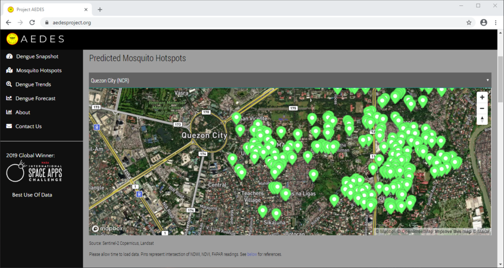
Correlating information from Sentinel-2 Copernicus and Landsat 8 satellites, climate data from the Philippine Atmospheric, Geophysical and Astronomical Services Administration of the Department of Science and Technology (DOST-PAGASA) and trends from Google search engines, potential dengue hotspots will be shown in a web interface.
Using satellite spectral bands like green, red, and near-infrared (NIR), indices like Fraction of Absorbed Photosynthetically Active Radiation (FAPAR) and Normalized Difference Vegetation Index (NDVI) are calculated in identifying areas with green vegetation while Normalized Difference Water Index (NDWI) identifies areas with water. Combining these indices reveal potential areas of stagnant water capable of being breeding grounds for mosquitoes, extracted as coordinates through a free and open-source cross-platform desktop geographic information system QGIS.
https://www.youtube.com/watch?v=uzpI775XoY0
Check out the website here: http://aedesproject.org/
“AEDES aims to improve public health response against dengue fever in the Philippines by pinpointing possible hotspots using Earth observations,” Dr. Argyro Kavvada of NASA Earth Science and Booz Allen Hamilton explained.
The DOST-Philippine Council for Industry, Energy and Emerging Technology Research and Development (DOST-PCIEERD) deputy executive director Engr. Raul C. Sabularse said that the winning solution “benefits the community especially those countries suffering from malaria and dengue, just like the Philippines. I think it has a global impact. This is the new science to know the potential areas where dengue might occur. It is a good app.”
“It is very relevant to the Philippines and other countries which usually having problems with dengue. The team was able to show that it’s not really difficult to have all the data you need and integrate all of them and make them accessible to everyone for them to be able to use it. It’s a working model,” according to Monchito B. Ibrahim, industry development committee chairman of the Analytics Association of the Philippines and former undersecretary of the Department of Information and Communications Technology.
The leader of the Space Apps global organizing team Dr. Paula S. Bontempi, acting deputy director of the Earth Science Mission, NASA’s Science Mission Directorate remembers the pitch of the winning team when she led the hackathon in Manila. “They were terrific. Well deserved!” she said.
“I am very happy we landed in the winning circle. This would be a big help particularly in addressing our health-related problems. One of the Sustainable Development Goals (SDGs) is on Good Health and Well Being and the problem they are trying to address is analysis related to dengue,“ said Science and Technology secretary Fortunato T. de la Peña. Rex Lor from the United Nations Development Programme (UNDP) in the Philippines explained that the winning solution showcases the “pivotal role of cutting-edge digital technologies in the creation of strategies for sustainable development in the face of evolving development issues.”
U.S Public Affairs counselor Philip W. Roskamp and PLDT Enterprise Core Business Solutions vice president and head Joseph Ian G. Gendrano congratulates the next group of Pinoy winners.
Sec. de la Peña is also very happy on this second time victory for the Philippines on the global competition of NASA. The first winning solution ISDApp uses “data analysis, particularly NASA data, to be able to help our fishermen make decisions on when is the best time to catch fish.” It is currently being incubated by Animo Labs, the technology business incubator and Fab Lab of De La Salle University in partnership with DOST-PCIEERD. Project AEDES will be incubated by Animo Labs too.
University president Br. Raymundo B. Suplido FSC hopes that NASA Space Apps would “encourage our young Filipino researchers and scientists to create ideas and startups based on space science and technology, and pave the way for the promotion and awareness of the programs of our own Philippine space agency.”
Philippine vice president Leni Robredo recognized Space Apps as a platform “where some of our country’s brightest minds can collaborate in finding and creating solutions to our most pressing problems, not just in space, but more importantly here on Earth.”
“Space Apps is a community of scientists and engineers, artists and hackers coming together to address key issues here on Earth. At the heart of Space Apps are data that come to us from spacecraft flying around Earth and are looking at our world,” explained by Dr. Thomas Zurbuchen, NASA associate administrator for science.
“Personally, I’m more interested in supporting the startups that are coming out of the Space Apps Challenge,” according to DOST-PCIEERD executive director Dr. Enrico C. Paringit.
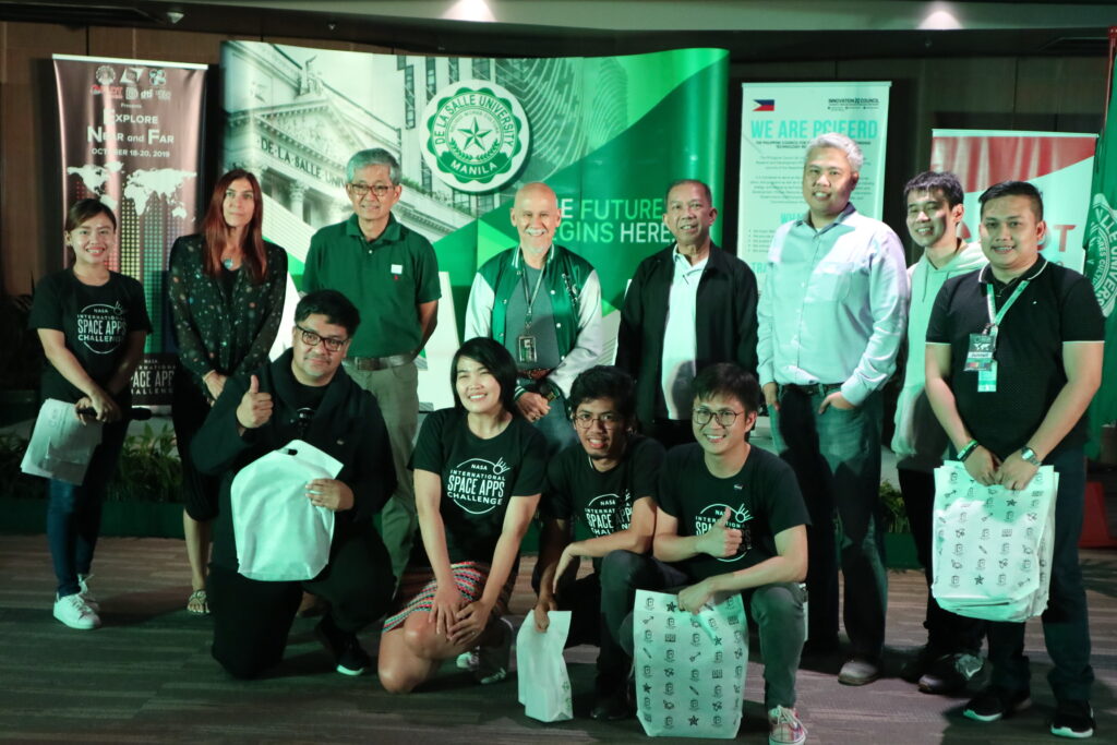
In the Philippines, Space Apps is a NASA-led initiative organized in collaboration with De La Salle University, Animo Labs, DOST-PCIEERD, PLDT InnoLab, American Corner Manila, U.S. Embassy, software developer Michael Lance M. Domagas, and celebrates the Design Week Philippines with the Design Center of the Philippines of the Department of Trade and Industry. It is globally organized by Booz Allen Hamilton, Mindgrub, and SecondMuse.
Space Apps is a NASA incubator innovation program. The next hackathon will be on October 2–4, 2020.
#SpaceApps #SpaceAppsPH
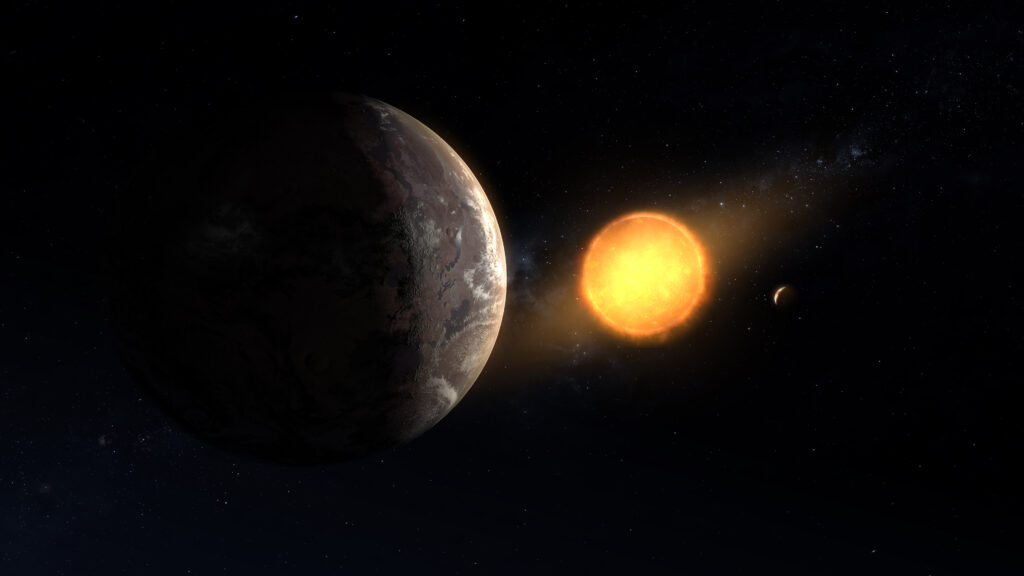
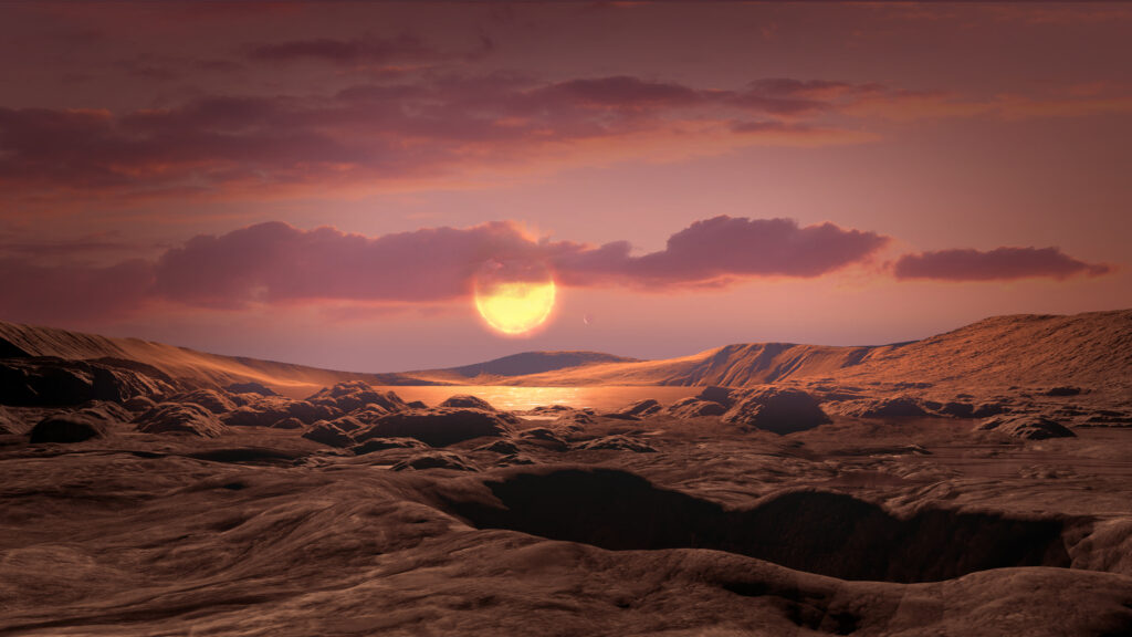
A team of transatlantic scientists, using reanalyzed data from National Aeronautics and Space Administration’s Kepler space telescope, has discovered an Earth-sized exoplanet orbiting in its star’s habitable zone, the area around a star where a rocky planet could support liquid water.
Scientists discovered this planet, called Kepler-1649c, when looking through old observations from Kepler, which the agency retired in 2018. While previous searches with a computer algorithm misidentified it, researchers reviewing Kepler data took a second look at the signature and recognized it as a planet. Out of all the exoplanets found by Kepler, this distant world – located 300 light-years from Earth – is most similar to Earth in size and estimated temperature.
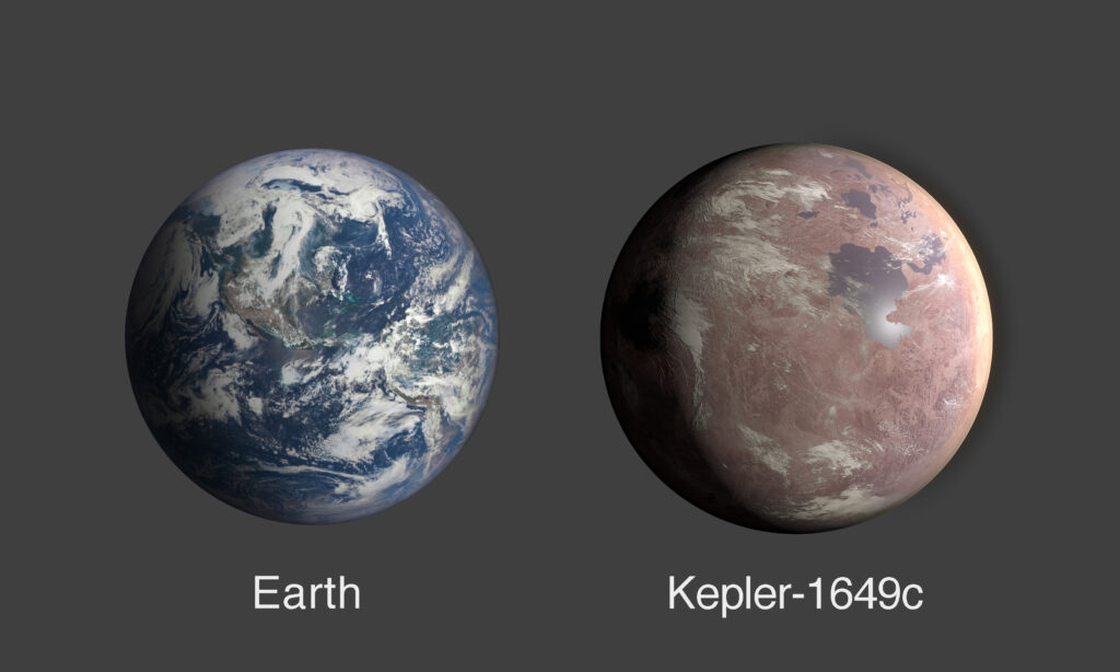
This newly revealed world is only 1.06 times larger than our own planet. Also, the amount of starlight it receives from its host star is 75% of the amount of light Earth receives from our Sun – meaning the exoplanet’s temperature may be similar to our planet’s, as well. But unlike Earth, it orbits a red dwarf. Though none have been observed in this system, this type of star is known for stellar flare-ups that may make a planet’s environment challenging for any potential life.
“This intriguing, distant world gives us even greater hope that a second Earth lies among the stars, waiting to be found,” said Thomas Zurbuchen, associate administrator of NASA’s Science Mission Directorate in Washington. “The data gathered by missions like Kepler and our Transiting Exoplanet Survey Satellite (TESS) will continue to yield amazing discoveries as the science community refines its abilities to look for promising planets year after year.”
There is still much that is unknown about Kepler-1649c, including its atmosphere, which could affect the planet’s temperature. Current calculations of the planet’s size have significant margins of error, as do all values in astronomy when studying objects so far away. Rocky planets orbiting red dwarfs are of particular astrobiological interest. However, astrobiologists will need much more information about this planet in order to gage whether it is promising for life as we know it. But based on what is known, Kepler-1649c is especially intriguing for scientists looking for worlds with potentially habitable conditions.
There are other exoplanets estimated to be closer to Earth in size, such as TRAPPIST-1f and, by some calculations, Teegarden c. Others may be closer to Earth in temperature, such as TRAPPIST-1d and TOI 700d. But there is no other exoplanet that is considered to be closer to Earth in both of these values that also lies in the habitable zone of its system.
“Out of all the mislabeled planets we’ve recovered, this one’s particularly exciting – not just because it’s in the habitable zone and Earth-size, but because of how it might interact with this neighboring planet,” said Andrew Vanderburg, a researcher at the University of Texas at Austin and first author on the paper released today in The Astrophysical Journal Letters. “If we hadn’t looked over the algorithm’s work by hand, we would have missed it.”
Kepler-1649c orbits its small red dwarf star so closely that a year on Kepler-1649c is equivalent to only 19.5 Earth days. The system has another rocky planet of about the same size, but it orbits the star at about half the distance of Kepler-1649c, similar to how Venus orbits our Sun at about half the distance that Earth does. Red dwarf stars are among the most common in the galaxy, meaning planets like this one could be more common than we previously thought.
Previously, scientists on the Kepler mission developed an algorithm called Robovetter to help sort through the massive amounts of data produced by the Kepler spacecraft, managed by NASA’s Ames Research Center in California’s Silicon Valley. Kepler searched for planets using the transit method, staring at stars, looking for dips in brightness as planets passed in front of their host stars.
Most of the time, those dips come from phenomena other than planets – ranging from natural changes in a star’s brightness to other cosmic objects passing by – making it look like a planet is there when it’s not. Robovetter’s job was to distinguish the 12% of dips that were real planets. Those signatures Robovetter determined to be from other sources were labeled “false positives,” the term for a test result mistakenly classified as positive.
With an enormous number of tricky signals, astronomers knew the algorithm would make mistakes and would need to be double-checked – a perfect job for the Kepler False Positive Working Group. That team reviews Robovetter’s work, going through all false positives to ensure they are truly errors and not exoplanets, ensuring fewer potential discoveries are overlooked. As it turns out, Robovetter had mislabeled Kepler-1649c.
Even as scientists work to further automate analysis processes to get the most science as possible out of any given dataset, this discovery shows the value of double-checking automated work. Even six years after Kepler stopped collecting data from the original Kepler field – a patch of sky it stared at from 2009 to 2013, before going on to study many more regions – this rigorous analysis uncovered one of the most unique Earth-analogs discovered yet.
Kepler-1649c not only is one of the best matches to Earth in terms of size and energy received from its star, but it provides an entirely new look at its home system. For every nine times the outer planet in the system orbits the host star, the inner planet orbits almost exactly four times. The fact that their orbits match up in such a stable ratio indicates the system itself is extremely stable, and likely to survive for a long time.
Nearly perfect period ratios are often caused by a phenomenon called orbital resonance, but a nine-to-four ratio is relatively unique among planetary systems. Usually resonances take the form of ratios such as two-to-one or three-to-two. Though unconfirmed, the rarity of this ratio could hint to the presence of a middle planet with which both the inner and outer planets revolve in synchronicity, creating a pair of three-to-two resonances.
The team looked for evidence of such a mystery third planet, with no results. However, that could be because the planet is too small to see or at an orbital tilt that makes it impossible to find using Kepler’s transit method.
Either way, this system provides yet another example of an Earth-size planet in the habitable zone of a red dwarf star. These small and dim stars require planets to orbit extremely close to be within that zone – not too warm and not too cold – for life as we know it to potentially exist. Though this single example is only one among many, there is increasing evidence that such planets are common around red dwarfs.
“The more data we get, the more signs we see pointing to the notion that potentially habitable and Earth-size exoplanets are common around these kinds of stars,” said Vanderburg. “With red dwarfs almost everywhere around our galaxy, and these small, potentially habitable and rocky planets around them, the chance one of them isn’t too different than our Earth looks a bit brighter.”
Missions such as Kepler and TESS help contribute to the field of astrobiology, the interdisciplinary research into understanding how the variables and environmental conditions of distant worlds could harbor life as we know it, or whatever other form that life could take.
From the US territory Guam, sightings came in of a fireball falling from the sky. The strategic location of Guam and the U.S. military stationed there has drawn attention for years. Guam thrust into the limelight during heightened tensions with North Korea. In August 2017, North Korea launched missiles that flew over Japan and into the northern Pacific Ocean in an apparent attempt to threaten the US territory of Guam. North Korean leader Kim Jong Un did not follow up on his threats, but a fireball came crashing down from a different source.
Local officials quickly released an announcement indicating the Chinese Long March Launch as a likely source of the fireball. Indeed, an Indonesia satellite launched on a Chinese rocket came crashing back to Earth. The satellite failed to reach orbit. The failure of the new communications satellite for Indonesia to reach orbit marked the second failure for china’s space agency in less than a month, state media reported April 9.
It is unlike the Chinese Long March 3, workhorse of the Chinese launch industry, series rocket to fall. According to the Xinhua News Agency, the rocket lifted off at 7:46 p.m local time from China’s Xichang Satellite Launch Center in the Sichuan province. The rocket traveled according to plan during the first and second stages. The Rocket third stage experienced abnormal conditions.

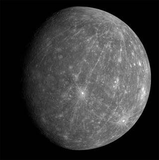
The ESA probe BepiColombo flew past Earth on the way to Mercury. The probe launched in 2018 and made the last visit of our home before continuing onward to the final destination. The spacecraft needs to shed velocity to arrive at Mercury in 2025 at a velocity to enter orbit. The spacecraft will make multiple additional planetary flybys of Venus and Mercury to slow down to enter orbit.
In space travel, mission planners need to balance mission resources. The amount of fuel required to either speed up or slow down a spacecraft greatly impacts the cost of the mission. Using a longer flight path can reduce the propellent requirements for a mission but the mission will take longer. Gravity assists can, therefore, allow a spacecraft to be launched on a cheaper, less powerful rocket.
Gravity assist flyby?
A Gravity assist flyby has other names including a gravitational slingshot, gravity assist maneuver, or swing-by. Gravity assistance maneuvers increase or decrease its speed or redirect the orbital path. The spacecraft slingshots around another object with a gravitational field and transfers some of the energy during that slingshot. In the case of BepiColombo, the spacecraft needs to slow down to be captured by Mercury…
By Bill D’Zio, Originally posted on www.westeastspace.com March 28, 2020
NASA may have sidelined the Lunar Gateway for a return mission to the Moon, but it is not stopping the momentum. NASA has awarded several contracts for the Lunar Gateway including the most recent one to SpaceX. This demonstrates the growing capabilities of New Space companies to capture contracts and complete missions.
“This contract award is another critical piece of our plan to return to the Moon sustainably. The Gateway is the cornerstone of the long-term Artemis architecture and this deep space commercial cargo capability integrates yet another American industry partner into our plans for human exploration at the Moon in preparation for a future mission to Mars.”
NASA Administrator Jim Bridenstine in a press release statement about the award to SpaceX.
NASA Awarded SpaceX the first Artemis Gateway Logistics Services (GLS) contract. The award for resupply services to the Gateway will require delivery of goods to a Near Rectilinear Halo Orbit (NRHO). Not sure what a NRHO orbit is? A NRHO is a highly elliptical orbit that takes about 7 days for each orbit. Want some more details, just click here: Near Rectilinear Halo Orbit (NRHO). There are a few options for NRHO orbits, but NASA is leaning towards the L2 9:2 lunar synodic resonant southerly Near-Rectilinear Halo Orbit (NRHO) which would be the likely location of the lunar Gateway. A simplification of the orbit is shown below.
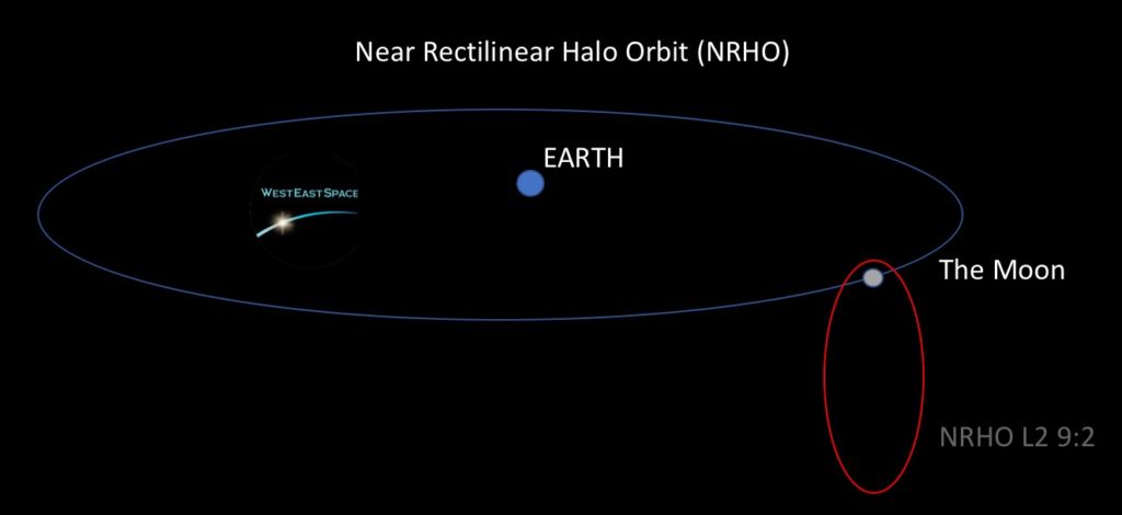
Cargo and payloads would be delivered to to the Gateway in NRHO above the moon. Deliveries would be made with the he Logistics Module (LM). The acronym LM may be slightly confusing for some people familiar with the Apollo Missions done fifty years earlier. The LM for the Apollo Missions was the “Lunar Module”. (Note LM “Lunar Module” was shortened from LEM “Lunar Excursion Module”)
Based on the 2019 NASA draft RFP document (GLS-RQMT-001) the Logistics Module (LM) will deliver a minimum 3400 kg (7496 lb) pressurized payload and cargo each mission to the Gateway under the NASA GLS contract. In addition to the the pressurized cargo, the LM will also deliver a minimum 1000 kg (2205 lb) unpressurized cargo and payloads per mission to the Gateway.
The proposed Canadian robotic arm (Canadarm3) would assist with unloading unpressurized cargo. The actual delivery of Robotic Arm was originally excluded as a potential baseline mission for cargo delivery as the mass of the the ISS Canadarm2 was 1,497Kg and 17 m long. The CSA concept for the Canadarm3 will be less than 900Kg and only 9 m because of the smaller size of the Lunar Gateway so it might also be considered for one of the first cargo delivery mission…
Read more here at www.westeastspace.com
Posted in alien life, astronomy, bioengineering, chemistry, DNA, Elon Musk, evolution, futurism, government, Mark Zuckerberg | Leave a Comment on AstroBiology and the Search for ExtraTerrestrial-Like Life!! — ideaXme — Dr. Penelope “Penny” Boston, PhD., Director of NASA’s Astrobiology Institute — Ira Pastor